Trail Walking Porto do Son - r01 ruta da ornanda - Photo

r01 ruta da ornanda

© OpenStreetMap contributors
Length
Length
9.2 km
Max alt
Max alt
132 m
Uphill gradient
Uphill gradient
247 m
Km-Effort
Km-Effort  
12.4 km
Min alt
Min alt
2 m
Downhill gradient
Downhill gradient
244 m
Boucle
Boucle
Yes
Creation date :
2018-04-17 11:48:15.737
Updated on :
2019-06-09 07:49:19.635

(0 Reviews)

Walking
Walking
--
Difficulty : Medium

Scan this QR Code to open this trail in the SityTrail application

FREE GPS app for hiking

Logo SityTrail SityTrail

IGN / Geographical institutes

Download SityTrail from the App Store Download SityTrail from Google Play

Logo SityTrail SityTrail World

The world is yours!

Download SityTrail from the App Store Download SityTrail from Google Play Download SityTrail on Huawei AppGallery

About

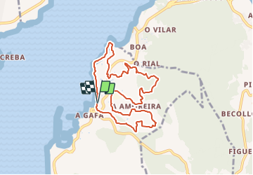
Trail Walking of 9.2 km to be discovered at Galicia, A Coruña, Porto do Son. This trail is proposed by joelledreessen.

Elevation profile

Positioning

Country:
Spain
Region :
Galicia
Department/Province :
A Coruña
Municipality :
Porto do Son
Location:
Unknown
Start:(UTM)
504987 ; 4734911 (29T) N.

Trails nearby

Trail Other activity Porto do Son - 10 km vers la Boule - Photo
Other activity
joelledreessen

Other activity

Very easy
Porto do Son, Galicia, A Coruña, Spain
10.7 km | 15.7 km-effort
1h 10min
Yes
Trail Walking Porto do Son - r16 ruta do monte iroite - Photo
Walking
joelledreessen

Walking

Very easy
Porto do Son, Galicia, A Coruña, Spain
17.3 km | 25 km-effort
Unknown
Yes
Trail Running Porto do Son - r02 ruta de a gafa e portosin - Photo
Running
joelledreessen

Running

Very easy
Porto do Son, Galicia, A Coruña, Spain
11.6 km | 16.5 km-effort
Unknown
Yes


Close
My subscriptions